- Cruise Planning Logistics
- Weather Routing
- Island Navigation
- Travel Planning
- Weather
- Communications
- Provisioning
- Safety and Health
Cruise Planning Logistics
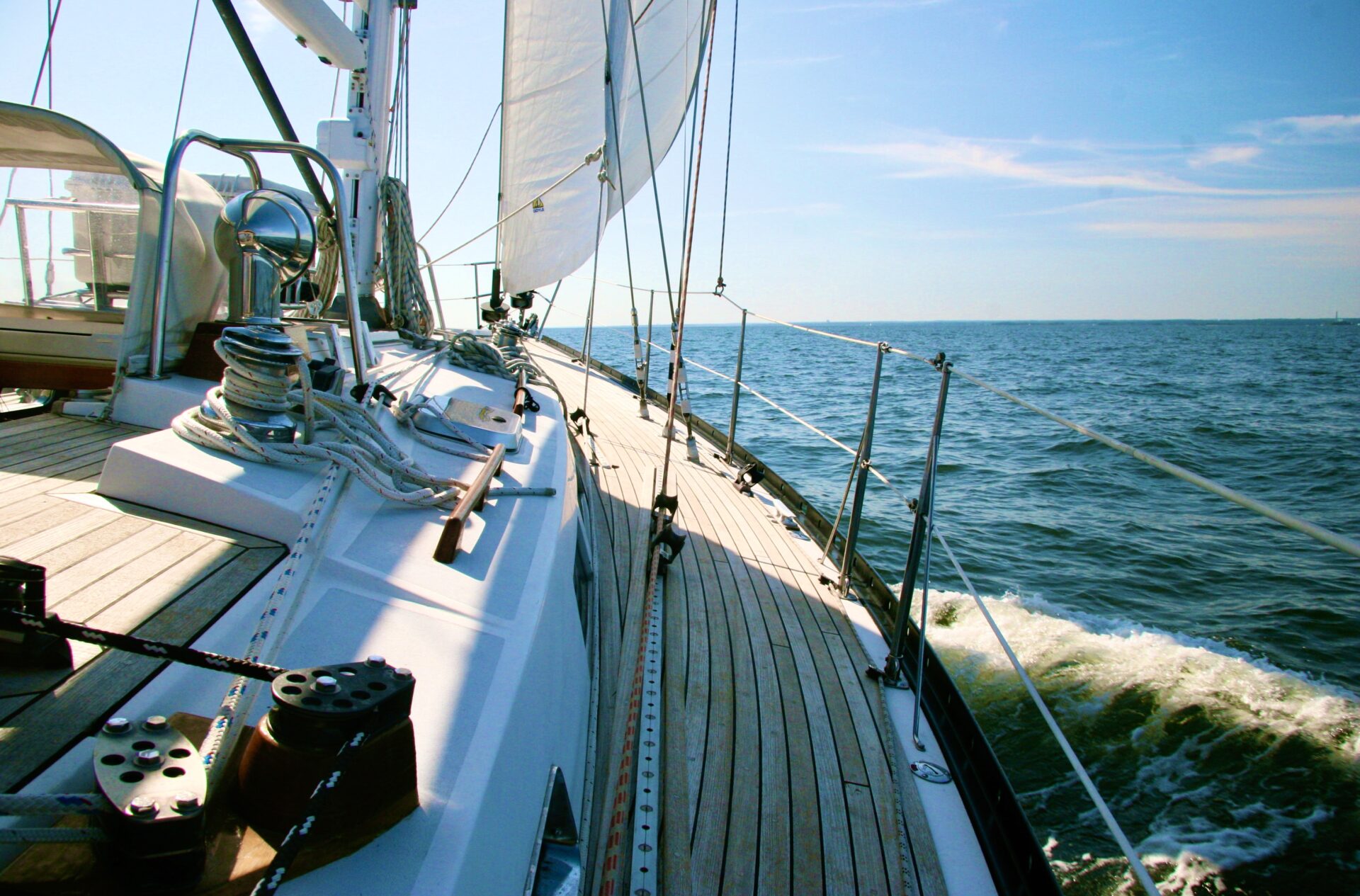
Each year thousands of sailors from both sides of the Atlantic converge on the Caribbean to explore the thousands of coves and anchorages to discover the many wonderful sights, sounds, cultures and colors that it offers. Many will arrive by air from the U.S. or Europe, to charter a boat, while others will make the passage aboard their own vessels.When contemplating a cruise through the Caribbean, there are myriad of questions and issues to be asked and answered.We have tried to address some of the more germane issues here for those looking to cruise the waters of the Antilles.
The considerations for information are somewhat different depending upon which of the above options is chosen.The cruiser will require a deeper understanding of the Caribbean weather patterns on a seasonal basis, while the yachtsman intending to charter will require a completely different set of data points.We have tried to strike a reasonable balance in this regard.
Cruising Your Own Boat

Cruisers en route to the Virgin Islands from North America have three distinct options when contemplating a winter in the Caribbean; they can migrate their way down the east coast, or intra-coastal waterway, to Florida and then embark on The “Thorny Path” to the Virgin Islands.The Thorny Path, as the name implies, is a long, sometimes difficult path that routes the vessel across the Bahamas where they will encounter the effects of the easterly trade winds as they enter the tropics en route to The Virgin Islands. Bruce Van Sant, in his book A Gentleman’s Guide to Passages South describes this route in detail and offers excellent advice on how to avoid many of the difficulties.
Sailing with Your Pets
A surprising number of cruisers bring their pets with them to the Caribbean. We have seen dogs and cats as well as a bird (in a cage) and a monkey! Back in the day…way back, we were living on a 32 foot sailboat in the Virgin Islands with three Labradors! In order to bring animals with you to a foreign port you must have proper paperwork with you showing proof of vaccinations etc. The requirements can be different for every country you visit. Now, Pet Passports has made bringing your animals along a much easier project! They have all the details you will need for almost every country in the world! Click on their link and be relieved that you won’t have to do nearly as much research as you thought.
Offshore Passage Making

For those contemplating making the offshore passage of some 1500 miles, from the East coast of the U.S., they will typically depart from ports like Newport, RI or Hampton, VA at the mouth of the Chesapeake Bay during early November in order to catch the short weather window between the tail end of the hurricane season (November 30th) and the start of the early winter gales in December. This is a real blue water offshore experience; the passage time is approximately 10 days, during which you are likely to encounter some challenging weather conditions including a Gulf Stream crossing.
The Caribbean 1500 Rally for Cruisers departs Hampton, VA around the first week of November annually and attracts a fleet of about 70 yachts of various sizes. This is an excellent way to make the passage in the company of other cruisers and with the added confidence of knowing that there is a support system close at hand, including a daily radio-net, lead boats sailing with the fleet, daily weather forecasts and a dedicated team ashore to manage the everything from celebrations to crisis. The rally organizers (World Cruising Club) in addition to providing a full program of social activities during the weeks prior to departure, also conduct excellent safety seminars on offshore passage making and boat safety.
For more information contact: http://www.worldcruising.com/carib1500

Caribbean bound sailors departing Europe and the Mediterranean before the onset of winter, will be able to take full advantage of the northeast trade winds on their passage across the Atlantic. The ARC Rally, also organized by the World Cruising Club, is the oldest sailing rally in the world and has run every year since 1986, offering a blend of parties, safe cruising and fun competition, departs annually from the Canary Islands in late November with a fleet of 200 plus vessels ending the 2,700 mile voyage on the island of St. Lucia in the Windward Islands.
After cruising the Windwards, the individual boats generally work their way north through the Leeward Islands and then onto the VIrgin Islands.
Some consideration needs to be given as to where the vessel will be at the start of the next year’s hurricane season. For boats heading back to Europe at the end of the Caribbean winter season (early May), the ARC Europe departs from Nanny Cay, Tortola en-route to Bermuda, where they rendezvous with the ARC Europe fleet departing Hampton, VA before setting sail for the Azores. The itinerary includes a cruise to several islands in the Azores before departing on the final leg of the rally to Largos in Portugal and other European ports. For U.S. east coast bound vessels, the Atlantic Cup Rally to Bermuda/Hampton, VA also departs Tortola, BVI in early May.
Ocean Transport

There is always the option of having your vessel shipped to the Virgin Islands, thereby saving the wear and tear on your yacht. Dockwise Yacht Transport departs from Fort Lauderdale in late October and then Newport, RI in early November and onto St. Thomas at a cost of about $US 11,000 (Ft. Lauderdale) to $US 14,500 (Newport) for a typical 40′ sailboat.
Customs Considerations
Each island group will have different requirements for cruising vessels and temporary importation.
The British Virgin Islands
Yachts visiting the BVI for the first time will be required to pay an Annual Tonnage Fee, which is based on your yacht’s new tonnage up to a limit of $55. If the vessel is to remain in the BVI for more than one month, there is a fee of $200 to temporarily import the yacht for up to a year. When arriving in the British Virgin Islands you must immediately proceed to a port of entry and clear customs and immigration. The skipper may present him/herself on behalf of the entire crew with passports, ships documentation and proof of clearance from the last port of call. If you are arriving after hours, raise the yellow Q flag and if possible notify customs by phone. In some instances it is possible to arrange for after hours clearance. Overtime fees will be applied. Guns of any kind are not allowed in the BVI. You must declare them and the police will take them and give you a receipt so that you can pick them up on your way out of the BVI.
In addition to the fees above, see the section in the Cruising Guide to the Virgin Islands entitled Customs, Immigration & Formalities for details on Cruising Permit & National Parks fee structure.
BVI Customs: 284-494-3475
The U.S. Virgin Islands
Vessels arriving in the USVI, regardless of flag or crew nationally, are required upon entry into US waters, to contact (via telephone) the nearest designated location and provide:
- Name, DOB and citizenship including passport number
- Name of vessel and documentation number
- CBP user fee number if applicable (see note)
- Homeport and current location
- Return contact number
Then (unless instructed to the contrary) proceed to the nearest port of entry, where the captain and crew are required to present themselves in person with all documentation. Yachts over 300 gross tons must send Advance Notice of Arrival to the U.S. Coast Guard 24 hours prior to arrival or they will not be admitted into the USVI.
(Check http://nvmc.uscg.gov/nvmc/default.aspx for further details of Advance Notice of Arrival “NOA.”) Non-USA crew or guests must have the requisite visas. For Yachtsman already in the Caribbean, U.S. visas can be obtained from the U.S. Embassy in Barbados after first obtaining an appointment. Cruising permits are not required in the USVI, however, vessels remaining six months or more are required to register with the Department of Planning & Natural Resources Environmental Enforcement Office (340-774-3320).
Vessels traveling between the BVI and USVI must clear out of the BVI waters at one of the ports of entry (West End ferry dock, Road Town, Jost Van Dyke, St. Thomas Bay Virgin Gorda, and Yacht Club Costa Smeralda Marina or Gun Creek in Gorda Sound, Virgin Gorda) and clear into U.S. waters either at Cruz Bay, St. John, Charlotte Amalie, St. Thomas or Gallow Bay, St. Croix.
When arriving into the US Virgin Islands from the BVI you must go to customs and immigrations first. If you arrive at night you should hoist the yellow quarantine flag and wait until customs and immigration are open in the morning and not leave the boat before clearing in with the officials.
USVI customs and immigration offices
Cruz Bay, St. John
Charlotte Amalie, St. Thomas
Redhook, St. Thomas
Gallows Bay, Christiansted, St. Croix.
USVI Customs: 703-526-4200
Weather Routing
There are numerous weather and routing services available to the cruising yachtsman, planning a trip to/from or through the islands of the Caribbean. These services are on a fee or subscription basis and can be general or customized to individual cruiser’s specific routes and departure dates.
Chris Parker at Caribbean Marine Weather Center is well-known to many Caribbean cruisers, supporting them with high value forecasting and routing services; allowing them to make good tactical decisions. He also supports an SSB Net in addition to individual services via email and phone.
For more information: www.caribwx.com
Chris also has an excellent book on the weather, available at our bookstore.
Coastal & Offshore Weather: The Essential Handbook – by Chris Parker
Weather Routing, Inc (WRI) is also a private forecasting company specializing in marine weather since 1961; providing marine weather forecasts and routing advice to yachtsmen worldwide for trans-ocean crossings, coastal transits, and area cruises. Individually prepared forecasts are customized specifically for your vessel’s needs and location and WRI meteorologists are available for consultation 24 hours a day, 365 days a year.
Island Navigation
Charts
The Virgin Islands
Complete paper chart coverage of the Virgin Islands will range from about $50.00 to several hundred dollars, especially if you include electronic charts which are now almost ubiquitous.
Charts can be hard to obtain in the islands, so taking your own charts is the best way to be sure you have the coverage you’re comfortable with.
The following paper charts, or chart kits cover the Virgin Islands and surrounding areas and they are available from our bookstore or larger chart agents in the U.S., and Canada and Europe.
NV Charts
This complete chart pack contains 13 charts and includes an electronic code that can be used in conjunction with the downloadable NV Chart App.
NOAA
- 25641 St. Thomas to Virgin Gorda
- 25647 East St. Thomas Pillsbury Sound, west St. John
- 25649 St. Thomas, South coast
- 25645 St. Croix, Christiansted
IMRAY-Iolaire
- A23 The Virgin Islands
- A231 St. Thomas to Virgin Gorda
- A232 Tortola to Virgin Gorda
- A234 St. Croix, Northeast coast
British Admiralty
- 2016 Puerto Rico to Leeward Islands
- 2006 Anegada to St. Thomas
- 2019 Road Harbour to North Sound Virgin Gorda
Electronic Charts & GPS
Used in combination with GPS and paper charts, electronic charts have become extremely popular, though they remain hard to purchase in the islands.
The majority of the charter fleets are now equipped with chart plotters, pre-loaded with software. If you are chartering, check with your charter company
what equipment and supporting software is aboard before purchasing any electronic charts.
Personal smart-phones preloaded with navigational apps should be used with caution, and settings adjusted to ensure that you are just utilizing the native app and the phones internal GPS function; otherwise you might be roaming on a network outside of your plan and therefore subject to high roaming rates.
The following electronic charts cover the Virgin Islands (and beyond) and are available from selected chart agents and marine electronic dealers in the U.S., Canada and Europe:
- Maptech: Companion CD Charts
- Admiralty Leisure: Electronic versions of the Leisure Folios
- NV Charts: Companion CD charts
- Chart-plotter Software
- C-Map: NAC501 Cuba to Trinidad
- Garmin: US030 Southeast Caribbean
- Navionics: 3XG: Central and South America
- Navionics: Mobile App for iPad and iPhone/Caribbean and South America
GPS/Waypoints
Windward Islands
Leeward Islands
Virgin Islands
Navigation throughout the Virgin Islands is mostly line of sight. It is of course mandatory to have updated charts aboard, both paper and electronic, but it is essential that you not rely on any one piece of information for the overall safety of your vessel. Your authors are not proponents of listing waypoint information that might be relied upon to take you through a narrow entrance in a reef. We have established waypoints outside of the anchorage and listed a suggested course. When necessary, post a lookout on the bow and never be complacent. Take visual sightings, depth readings and proceed with caution. GPS has been known to fail; software has been known to give false readings. There have been reports of navigators finding themselves a couple of miles away from where they expected in places where the GPS showed good correspondence. Occasional errors are a possibility.
The Cruising Guide to the Virgin Islands has adopted the following system of waypoint identification:
The British Virgin Islands carry a designator of BV (British Virgins) while in the U.S.Virgins they will be designated as UV (U.S. Virgins). They are further broken down by island or island group:
- Tortola, BVI 100
- Jost Van Dyke 200
- The Channel Islands (Norman, Peter, Salt & Cooper) 300
- Virgin Gorda and Anegada 400
- St. John, USVI 500
- St. Thomas 600
- St. Croix 700
Instructions for downloading the waypoint files:
110221finalWaypoints-converted.xls (Original Excel file data with decimal conversion and database)
110221finalWaypoints.gpx (Converted GPX file for your Garmin GPS)
For your reference, here is a screenshot of the Garmin Homeport.
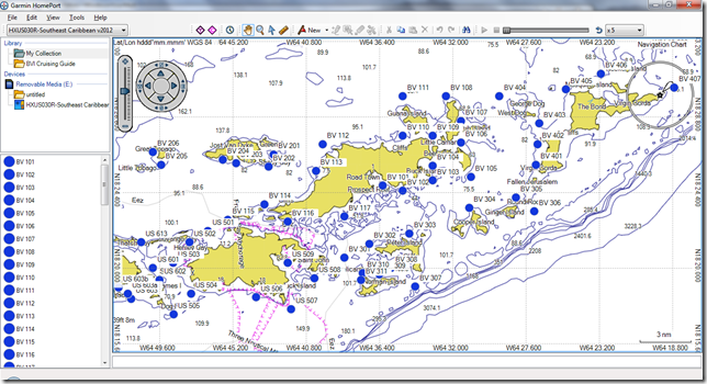
In case you need to output as a different file, the instructions are below.
110221finalWaypoints-converted.xls
This is a copy of the original xls.file from the Guide with:
(a) On the first page (‘Final’), an additional table to the right, where, in preparation for converting the data to chart plotter format, we have
- changed the waypoint names to the way they’re labeled on the charts (i.e. preceded by “US” and “BV”) and
- converted the lat/longs to degrees/decimal format.
(b) On the second page (‘Database’), in order to prepare to export the data to a CSV so it can be converted to GPX:
- Copied the new table from the ‘Final’ page and pasted it as values
- Deleted headers and blank lines
- Rearranged the column order
- Added the type column and populated it with “W” (for waypoint)
- Added the symbol column and populated it with “Circle, Blue” (just what happened to look best). This column can be deleted and the chart plotter software, upon importing the data, will use whatever its default is.
- Added the headers in the first row.
110221finalWaypoints.gpx
This file is ready to be imported. To generate it:
(a) In the xls file, copy the ‘Database’ page to a new file, and save that file in CSV format.
(b) Use the GPS Visualizer converter at http://www.gpsvisualizer.com/convert_input?convert_format=gpx to convert the CSV file into GPX format. It’s very simple to use:
- click on the Output format: GPX radio button
- upload the CSV file using the Browse… buttons; ignore the rest of the form
- click on the Convert button to the right.
- In a moment, the results page will appear, indicating (just below the banner ad) that “Your data has been converted to GPX.”)
- Just above the donate box, there’s a line that says “Click to download …”. This is the resulting GPX file, and you should be ready to go. You can copy/paste the XML from the text box below the Donate ad, but it’s just an extra step.
Buoyage System
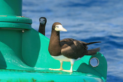
In an international effort to standardize buoyage systems, the International Association of Lighthouse Authorities (IALA) has agreed that, in order to meet conflicting requirements, there will be two systems in use throughout the world. These are called systems A and B, respectively.
The rules for the two systems were so similar that the IALA Executive Committee felt able to combine the two sets of rules into one, known as the IALA Maritime Buoyage System. This single set of rules allows lighthouse authorities the choice of using red to port or red to starboard on a regional basis, the two regions being known as Region A and Region B.
The latter system, system B, is used in North and South America and throughout the waters of the Caribbean. In system B the color red is used to mark the starboard side of the channel when approaching from seaward (red, right, returning). In this respect, it should be noted that the respective buoyage systems for both the U.S. and British Virgins are the same.
Sailing Itineraries
The Virgin Islands
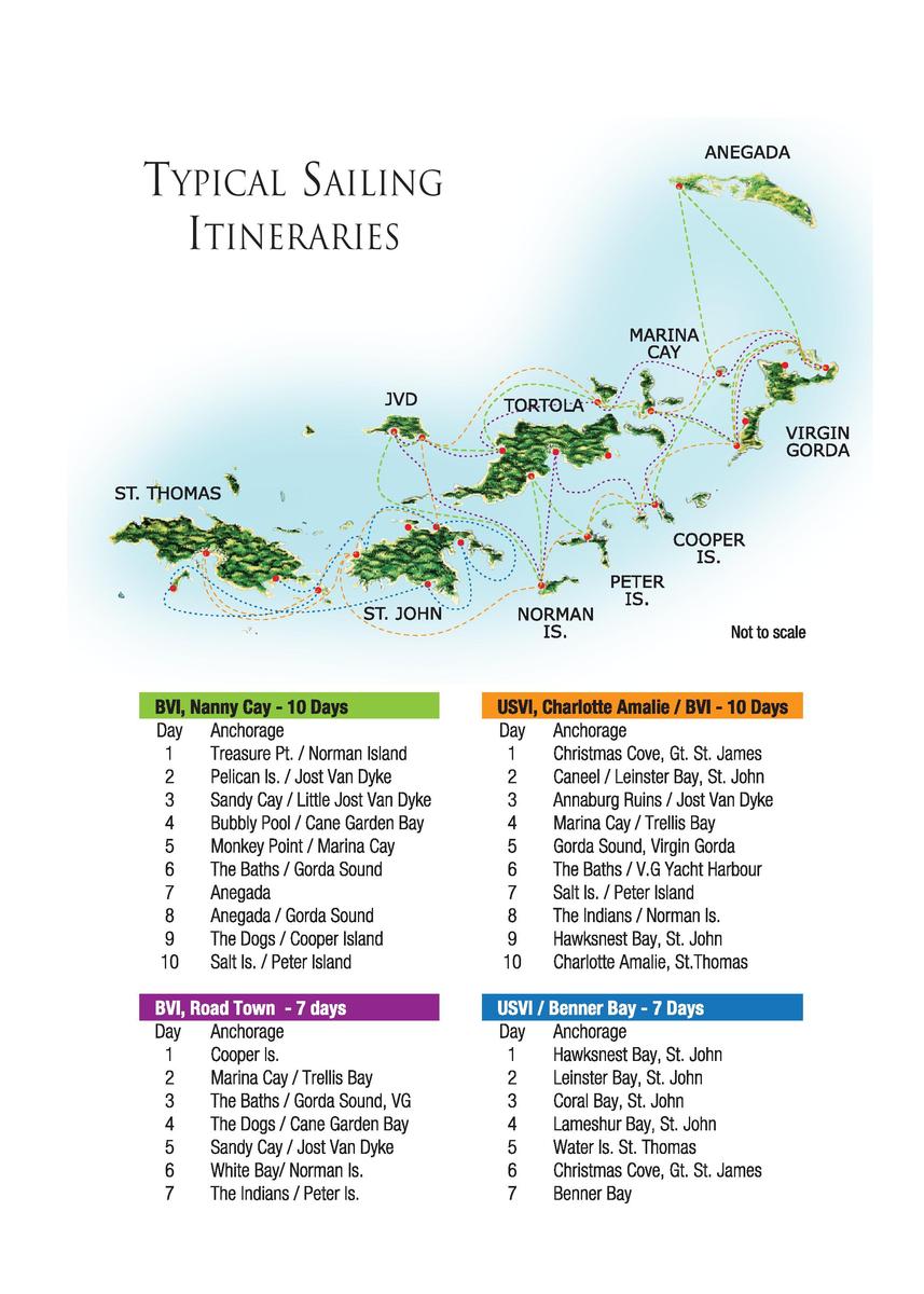
When planning your Virgin Island sailing trip it is important to determine the right balance between sailing, snorkeling, exploring. How experienced is the crew? What is the general appetite for the enthusiastic trade wind sailing? Are there divers aboard? Do you and the crew want to eat ashore every night? All of these factors will impact the way you plan your sailing adventure. One should clear, you should plan an itinerary with a blend of activities to suit everybody aboard and not try to fit everything into a seven-day cruise. The real pleasure of a vacation is having the freedom to change plans, stay in a beautiful anchorage for an extra day, or keep sailing when the conditions are perfect.The first day is critical and should be planned so that you get the crew to an anchorage, into the water and relaxed as soon as possible. Allow them to get accustomed to the environment and de-stress. Don’t overdo it with a long sail to weather.
Beyond the Virgins
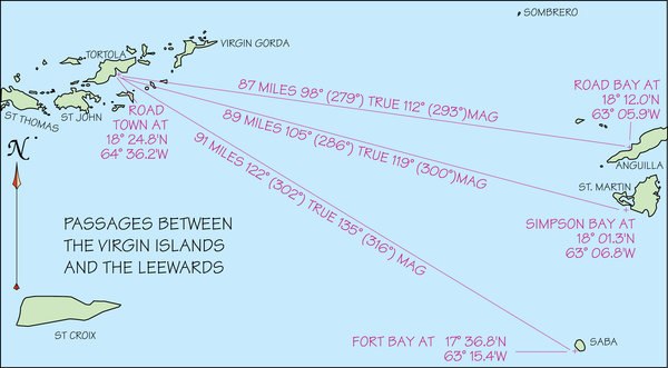
The northern most islands of the Leeward Islands, Anguilla, St. Martin and Saba, lie around 80-90 miles east of Virgin Islands and getting there entails crossing the Anegada Passage. A current from half a knot to a knot and a half usually flows in a westerly to northwesterly direction. The trade winds blow from the easterly quadrant. All of this makes it really easy to sail from the Leeward Islands to the Virgin Islands; it is downwind and down current. Conversely, the trip from the Virgins is tough, with both wind and current on the nose. Unless the wind is way in the northeast, you are unlikely to be able to lay even Saba on one tack, so unless you like heavy weather beating in short seas, avoid the strong Christmas winds. Approaching cold fronts can be preceded by calm days, which could provide a weather window if a 90-mile motor sail works for you. If schedule dictates that you must sail south during periods of strong north-easterlies, an alternative course would take you southeast from the Virgin Islands to Saba (passing west of the Saba Bank) and onto St. Kitts before heading east.
When conditions are favorable, it is best to depart the Virgin Islands from the most northerly point in order to deal with the wind and current. The BVI departure points would be via the Round Rock Passage, south of Virgin Gorda, or the Necker Island Passage, north of Gorda Sound. A late afternoon departure should get you into St. Martin by mid-day.
The Leeward Islands are covered in The Cruising Guide to the Northern Leeward Islands and The Cruising Guide to the Southern Leeward Islands by Chris Doyle.
Travel Planning
Packing For The Cruise
Life in the islands is very laid back and informal. Nearly all visitors bring too much luggage and unless you plan on spending time at upscale resorts, we suggest a very minimalist approach. Bathing suits, T-Shirts, polo’s and shorts plus a pair of slacks and shirt for the men, the ladies may also consider a light non-wrinkle dress. Sailing hats, gloves and light cotton socks to cover up sun burned feet and ankles for those with fair or sensitive skin. A light windbreaker is a good addition especially during the winter months. With the airlines starting to charge by the checked bag, save yourself a few dollars and pack it in a single collapsible duffel bag. Less is more!
Tropical Clothing
The tropical lifestyle both on and around the water calls for a unique combination of apparel. The new “technical” fabrics shed water and distribute body heat. Light, loose-fitting cottons are perfect for the tropical environment; whether you are sailing, hiking or sea kayaking, adequate footwear, that is highly breathable and quick drying is essential. There are a number of Caribbean clothing brands, like Hiho and Pusser’s that have designed entire lines around the island and sailing lifestyles.
For more information
Currency
In the US & British Virgin Islands the US dollar is accepted. Anguilla, Antigua, St. Kitts, Nevis, Dominica, Barbuda and Montserrat share a common British heritage and a common currency, The Eastern Caribbean (EC) dollar. Banks give a fixed rate of around $2.67 to the US dollar. Shops, taxi drivers convert at $2.60. Wherever EC is used, always ask what kind of dollars in order to avoid confusion.
In St. Martin, St. Barts and Guadeloupe the currency is the Euro, which will vary against the US Dollar (see currency converter). The Dutch islands (Saba, Statia, and St. Maarten) converted from the Guilder to the Euro in 2002, however US dollars are widely accepted.
Language
English is spoken widely throughout the Caribbean with the possible exception of Guadeloupe, where you will still find people who speak only French. In this case Kathy Parsons little book French for Cruisers is very helpful with everything from eating out to engine parts.
Local Etiquette

- Clothing: When visiting the islands of the Caribbean it is important to remember that although we may be on vacation, we are visitors in another country and therefore should respect local cultures. The people of the Caribbean are quite conservative at heart and will look askance if you wander away from the beach in a bathing suit. A shirt and a pair of shorts are appropriate. Topless sunbathing for women varies by island. In Martinique it is common on the beaches, but frowned upon in most of the other islands. Take a look around and see what others are doing. Complete nudity should be confined to the boat, or extremely secluded beaches.
- Greetings: Throughout the Caribbean manners are extremely important and it is considered poor form to approach someone with a question or to transact business without beginning with the appropriate greeting. “good morning” or “good afternoon” and “bonjour” or “bonne nuit” in the French islands.
- Tipping: Always a difficult subject. Everyone likes to be tipped, but it is not always expected. In restaurants where no service charge is added, a 10%-15% tip is considered normal. If service has been added, a small tip is appreciated but not essential. Taxi drivers do not normally expect to be tipped unless they go out of their way to help you. A few dollars added to the fair is always appreciated. Further down islands where the local currency is in EC (Eastern Caribbean), if you get help from local kids with bags, they will expect one or two EC dollars.
Weather
General Climate
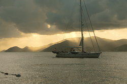
Located in the northeast trade wind belt, the Virgin Islands are blessed with excellent sailing conditions almost year round. During the winter months when the wind conditions are at their highest, the geographical make up of the islands tends to shelter the sailing area, making for much easier sea conditions than one might logically expect in the vicinity of both the Leeward and Windward islands further to the South. That being said, it is important to understand the seasons of the Caribbean weather patterns, which can be viewed as follows:
Winter (December–March)
This period can be characterized by heavy sailing conditions with winds and seas reflecting the strong blustery trade winds prevailing at this time. The winds at this time are also referred to as Christmas winds largely referring to the entire season versus late December and early January. The winds during this period can blow from 18-30 knots, more often than not in 3-4 day cycles created by passing high pressure systems.
Spring (April–June)
This is perhaps the most settled time of the year and certainly my personal favorite sailing time. The winter trade winds have diminished to a steady 10-15 knots from the Northeast to South of East when not modified by tropical waves. Rainfall during this period is light.
Summer (July–October)
Although hurricane season officially starts on June 1 and continues through November 30, according to weather expert David Jones (see note below), statistically, early (June) tropical cyclone activity tends to occur in the western Caribbean. By midseason, (July to early August) it is more likely to occur within a few hundred miles of the island chain. At the peak of the season (late August to September) it occurs mainly in the South of the North Atlantic, thousands of miles from the Virgins before reverting back in October to the eastern and western Caribbean.
Fall (November–mid-December)
A transitional season from the typical summer weather patterns with passing tropical wave activity, to the clearer, heavier trade wind conditions associated with non-tropical weather. This period is an extremely short window of opportunity for cruisers to reposition themselves prior to the onset of the heavy trade wind conditions that prevail during the winter months.
Note: An excellent reference source for cruisers wishing to understand Caribbean weather patterns is The Concise Guide to Caribbean Weather by the late David Jones. Copies of this book are now limited due to the author’s passing. Other excellent reference books are:
- Coastal & Offshore Weather: The Essential Handbook – by Chris Parker
- Weather at Sea – by David Hougton
Weather Forecasts
Unlike that of most other parts of the world, the weather in the Virgin Islands is relatively stable. Forecasts are broadcast daily on most of the local stations:
- St. Thomas: WIVI 99.5 FM (Forecasts at 07:30, 08:30, 15:30, 16:30 with hourly updates); WVWI 10:00 (Forecasts hourly); WSTA 1340 AM; Radio Antilles 830 AM
- St. Croix: WSTX 970 AM
- Tortola: ZBVI 780 AM, updates hourly on the half-hour 07:30 to 21:30
- Puerto Rico: WOJO 1030 AM (English-speaking all day at 6 minutes past the hour). NOAA Weather is broadcast throughout the day on WX3 or 4 or 6 on your VHF radio.
Wind Conditions
Owing to the northeast trade winds, the movements of the Bermuda High dominate the wind direction throughout the Virgins. During the winter months of December through March the typical prevailing wind is from the northeast at 18-25 knots. The occasional stronger cold fronts, associated with low-pressure systems, make their way southeast to reach the Virgin Islands. The initial effect will be lighter winds for several hundred miles ahead of the front. As a strong front approaches, the wind will start to move south and then southeast immediately ahead of the cold front. As the front passes the wind will shift to the northwest and increase to 20-30 knots with blustery conditions. It should be noted that trade winds conditions are not always stable and can vary in direction by up to 45 degrees during a single day. By March, the winds start to move around to the east, and by June, they are blowing out of the southeast at 10-15 knots. During September to October, the trade winds are at their weakest and the weather can be less settled due to developing low-pressure systems. By November, the high-pressure system around Bermuda starts to stabilize and 15-20 knot breezes become the norm.
Storms and Hurricanes
The Virgin Islands have fewer storms than does the Long Island Sound in New York. When the islands do experience a tropical storm or depression, it is usually in the early development of the storm center, and the storms usually do not reach full intensity until they are north of the area. Should a storm approach the islands, remember that they travel very slowly; consequently, with the communication systems used today, sailors can be assured of at least 48 hours warning.
In the event of a severe tropical storm or hurricane, approaching the Virgin Islands, you will be kept well notified by both the local radio stations, VHF marine advisory channels, SSB and, in the case of charter vessels, your local charter company. All major charter companies have well prepared hurricane plans and they will advise you how to proceed. All vessels in the Caribbean during the hurricane season should carefully monitor the progress of each tropical system and act accordingly.
Communications
Connectivity has become such a major factor in our lives that staying in touch with friends and family while traveling is now more a necessity than a luxury. For cruisers, being in touch is essential, whether it be for safety, weather information or just communicating with other cruisers.
Cellular Telephones
For Virgin Island yachtsmen who need to keep in touch, cellular telephone service is generally available throughout the Virgin Islands. Cellular phones can be used for everything from checking in with the office, the family, or for local applications like ordering more provisions and making dinner reservations.
A word of caution: using a U.S. or European cell phone (if they will work) means that you will be roaming in an international area and are therefore very likely to end up with a large bill in the post upon your return home. Check with your service provider regarding roaming charges, or consider renting a local phone, or SIM card for your personal smart phone. Remember to turn cellular data off on smart phones to avoid hefty fees for a text message that reads, “Hey” from someone back home who forgot you’re on vacation. To obtain a local BVI cell phone, you can go to Cable & Wireless (Lime), CCT Global, or Digicel to rent either a cell phone that will work in the BVI, or a SIM card for your own telephone. Renport, at Wickham’s Cay II, rents cell phones, along with DVDs, CDs, etc. If you rent a local BVI cell phone and call the U.S., you may be paying a lot for that, however, the telephone usage within the BVI will be more reasonable. Many people rent cell phones for emergencies, or critical communications.
Area Codes
- Bahamas 242
- Dominican Republic 809
- Puerto Rico 787
- U.S. Virgin Islands 340
- British Virgin Islands 284
- Anguilla 264
- St. Maarten (Dutch) 721
- Saint Martin/St. Barts 590
- Antigua 268
- Guadeloupe 590
- Dominica 767
- Martinique 596
- St. Lucia 758
- St. Vincent 784
- Grenada 473
- Trinidad 868
VHF
Almost every boat sailing the Virgins will be equipped with a VHF radio. Apart from single side band for offshore communications, VHF is used for all local traffic. The channels vary from boat to boat, but the most commonly used frequencies are listed below.
- Channel 16: Initial calling, standby and international distress frequency. Switch to a working channel after contact is established
- Channel 12: Portside operations (charter company to yacht)
- Channel 6: Ship-to-ship, safety
- Channel 24, 85 and 87: W.A.H. Virgin Islands Radio
- Channel 67: VISAR (BVI) working frequency
- Channel 68,69,71,78,79 and 80: Non-commercial working channels
- Channel 22A: Coast Guard (“A” is U.S. mode), make initial contact on channel 16
- Channel WX-1 (162.55), WX-2 (162.4), WX-3 (162.475): NOAA Weather broadcasts.
Do not allow children or crew-members to use the VHF without adequate instruction.
Distress Calling
Virgin Islands
VISAR and the US Coast Guard monitor VHF 16 radio 24 hours a day in case of emergencies.
U.S. Coast Guard: 787-729-6770
VISAR: 999 or 911 or 767 (SOS)
VHF Emergency Procedure
- Stay calm; don’t panic.
- Don’t allow anyone to use the radio unless they are familiar with the procedure and the problem.
- State name of vessel
- Location (Lat/Long) additional information if pertinent
- State nature of problem
Single Side Band (SSB)
The primary Caribbean hailing frequency is 8104.0 USB. Once contact is established you will need to switch to a working frequency. This frequency is also used at 8.15 am each morning to broadcast the Safety & Security Net.
The Caribbean SSB Weather Net
- 0630-0730 AST 8137kHz USB
- 0730-0830 AST 8137kHz USB
- 0830-0900 AST 8104kHz USB
- 0900-0930 AST 12359kHz USB
- 0930-1000 AST 16531kHz USB
Internet / Email
Generally speaking, cruisers should experience little difficulty in locating a WiFi hotspot or cyber cafe on most of the larger islands throughout both the BVI and USVI. Available bandwidth varies.
Many marinas offer “WiFi” to customers with a security code access. At times this access is via a professional gateway device designed for the job with a directional antenna, but in many instances it becomes just a wireless router on the marina managers desk. As a consequence, from time to time a reasonable signal can be received at anchor, but unless you have a high gain antenna, do not count on it. In the BVI you may consider renting a portable modem (USB) that allows you to connect wirelessly via the local service providers. This saves a considerable amount of frustration.
There is also a service based WiFi being implemented in conjunction with the BVI Tourist Board (www.bvimarinewifi.com). They advertise available WiFi at various hotspots throughout the BVI. The advertised fees range from $20 a day to $280 per month, but we have not used the service to-date.
VOIP (voice over internet protocol)
When reasonable bandwidth is available, phone calls can be made utilizing a VOIP service such as SKYPE, which enables you to use your computer to place a call to another computer, assuming they are online. You will want to turn off the video in order to preserve bandwidth. SKYPE also has a more interesting feature that is called SKYPE out. This allows you to call a telephone number anywhere in the world from your computer. You will need to establish an account, but the charges are minimal. The software can be downloaded to your computer for free, or you can utilize the SKYPE app on your smart phone providing it has a WiFi function.
Provisioning
Planning & Organization
Whether you are cruising or chartering, if you are provisioning you will need to start off with some organizational plan and structure. The simple method is to develop a chart by day, listing breakfast, lunch, dinner and snacks. Populate the chart with proposed meals and then list all the ingredients necessary to prepare them. If you already have some provisions on board, you can cross them off your list. The remaining items become your shopping list.
Draw a layout of your vessel, then list and assign a code to every locker and cabinet. As you stow your provisions, you can assign a location. That way you will not have to turn the boat upside down to find the simplest item on a daily basis.
The same approach is true of the refrigerator/freezer. Use plastic storage bins and note the contents and location. There is nothing worse than having to empty the entire contents of the on board refrigerator in order to locate the jar of mustard from yesterday’s lunch.
There are a number of books on the subject of organization aboard including one by Lin Pardy, The Care and Feeding of Sailing Crew, and another edited by Maria Russell called Best Tips From Women Aboard.
Provisioning Options
If you are chartering, most companies throughout the Caribbean offer a choice of provisioning options.
- Allow the company to provision for you from a pre-selected plan
- Provision yourself from one of the local markets
- Contract with an independent provisioning company
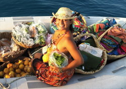
Having the charter company provision for you certainly saves on valuable charter time. An excursion to the local market will eat up half a day, plus taxi fares. This might offset any contemplated savings. The various plans consist of a full provisioning option that includes breakfast, lunch and dinner for the duration of your charter. A split plan will leave out several evening meals allowing you to eat ashore. Ask your charter company to send you the plans.
Self provisioning is an excellent choice if you or the crew has specific dietary needs, but as stated, it is time-consuming and if you are on a tight schedule, you may want to take a standard plan and supplement along the way.
Independent provisioning contractors essentially provide the same service as the charter company, however in some instances choices are available that are not part of the charter company package.
Restocking
One of the facts of life has to be that everybody needs to eat and therefore, almost without exception, wherever you drop your anchor, food will not be far away. That being said, we as cruisers should take advantage of the opportunity to try new foods, meet new people and sample the tastes of different cultures. However you provision your vessel, you will want to augment your supplies along the way. All of our Cruising Guide series from the Virgins to Trinidad include a list of markets, where you can replenish food, drink and ice.
Local Foods
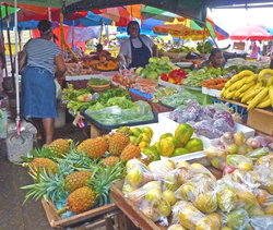
One of the best ways to experience local food and culture is to eat out. Throughout the chain, each island has local markets where you can purchase a variety of fresh local produce and usually discover something you haven’t tasted before. Part of the fun of a Caribbean sailing holiday is discovery and what better place to discover the wonderful variety of fruits and vegetables than in the bustling local markets, where you can experience the different flavors and spices that influence the cuisine.
Safety & Health
Sun Protection
Although difficult to comprehend as you dig your car out of the snow to get to the airport, the tropical sun is intense and adequate protection is essential. The constant trade breezes keep the temperatures ideal, but be careful as the combined effect of overhead sun and reflection from both sails and water can cause severe sunburn.
Bring down plenty of sunscreen (SPF 15+) and use it from the first day, building up exposure slowly. Heavy burning can still take place even on cloudy days, or in the shade. The tops of your feet are especially vulnerable, so bring along some light cotton socks, a pair of lightweight, or surgical pants, and long sleeve loose cotton tops and a wide-brimmed hat.
Dehydration
Water is a critical element of the body and adequate hydration is critical to good health. Since up to 75% of ones body weight is made up of water, dehydration occurs when the amount of water leaving the body exceeds the amount consumed. We routinely lose water when we breathe and humidified air exits the body, when we sweat to cool the body, and when we eliminate waste by urinating.
On a normal day a person has to drink a significant amount of water to replace this routine loss. The brush stroke formula is based on body weight, but approximately 60-70 fl. oz per day (1.7-2 liters) for the average 150-200lb (70-90 kg) sailor. When sailing in the tropics, sweat, alcohol usage, sea-sickness (vomiting) and diarrhea are the major contributing factors in dehydration. Symptoms may include decreased urine output, dry-mouth, lightheadedness. Make sure you and your crew drink at a minimum one liter every day in addition to other liquids. One of the downsides of a sailing holiday can be, of course, seasickness. Although it is unusual for people to feel sick for more than two days, it is none-the-less one of those few times you can feel so badly that you are not afraid of dying, you are more afraid of not dying! Although the Virgin Islands have relatively little wave action compared to the Leeward and Windward Islands, there are those who just look at a boat and turn green. It can happen at the most unpredictable times, and seasickness is always every bit as embarrassing as it is miserable for the victim. Over the years we have seen and heard all kinds of remedies and have tried most of them. Here is a list of products to help you prepare for your trip.
Seasickness
- One favorite is Sea Bands. These elastic wristbands have a small, plastic button that when placed in the right acupressure point on the inside of your wrist, helps to relieve symptoms. The bands come with easy instructions. They have no side effects, and are comfortable to wear. You may purchase them at drug stores. There are also other similar brands available. We have tried these numerous times with people who suffer from motion sickness at the slightest movement and have found them very successful.
- An old, natural remedy that again, has no side effects and is safe to use is a ginger capsule. Ginger has a settling effect on the stomach. These capsules are available in most health food stores.
- Dramamine, Marezine, and Bonine are the old stand-by, over the counter antihistamines. Dramamine in particular can make you very, very drowsy. You can miss some good times if you are sleeping the days away, however, it is better than being sick.
- For a prescription drug, ask your physician for Transderm Scop. This is only sold as a prescription, and can have some side effects. It does have some restrictions and is not safe for everyone. Transderm Scop comes in the form of a medicated patch that is worn behind the ear for up to three days at a stretch. Avoid reading and going below when you are underway. The fresh breeze can help, and also remember to look at the horizon instead of the waves passing next to the boat. Good luck, and let us hear from you if there are any other miracle cures around.
Water Safety
The waters of the Virgin Islands are essentially a benign area. When people think of tropical waters, man-eating sharks, barracuda and giant moray eels come to mind. The truth of the matter is that more injuries are sustained by cuts from coral or by stepping on sea urchin spines than by encounters with underwater predators.
It is against BVI law to import jet skis. If you have a jet ski aboard, you must declare it at customs when entering the BVI. Jet skis can be rented from local rental shops in certain locations. Jet skis are forbidden in the National Park Service waters in St. John and St. Croix.
Sharks: There are many large sharks around the waters of the Virgins, but they remain largely in deep water. It is highly unlikely that you will ever see a shark during your cruise.
Barracuda: You will, without doubt, see numerous barracuda of various sizes while snorkeling the reefs. They are curious fish and are likely to stay almost motionless in the water watching your movements. They will not bother you, and it is best to show them the same courtesy.
Moray Eels: These creatures are shy by nature and make their homes in rocks and crevices in the reef. They will protect themselves from perceived danger; so do not reach into caves or crevices unless you can see inside.

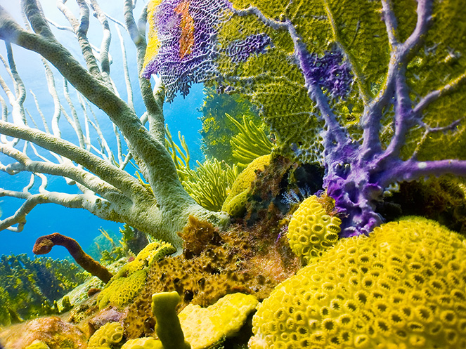
Coral: Exercise extreme caution around all coral, as cuts and scratches can become infected quickly. Familiarize yourself with the various types of coral and remember to stay well clear of the fire coral. To preserve the reefs, do not touch the coral, with your fins, your hands, or anything. Take only pictures, leave only bubbles.
Sea Urchins: These black, spiny creatures are found in abundance throughout the islands. They can be seen on sandy bottoms and on reefs and rocks. If you stand on one, or inadvertently place your hand on one, it is likely that one or more of the spines will pierce your skin and break off. Do not try to dig the spines out of your skin. Call a doctor for assistance.
If you observe the following basic rules on water safety, you will add to your enjoyment of the cruise:
- Don’t swim at night.
- Don’t swim alone.
- Don’t swim in heavy surf.
- Don’t dump refuse in the water–it is illegal and attracts sharks.
- Don’t wear jewelry when swimming or diving.
- Don’t reach into crevices or caves.
- Don’t spear a fish and leave it bleeding in the water or in a bag at your waist.
- Take no marine life without a permit!
- Don’t touch or anchor in coral under any circumstances.
- Don’t operate a dinghy at night without displaying a light.
Safety in the Islands
As with any destination in the world, there is always a chance of having something of value targeted by a thief. If you take precautions in advance, then you can enjoy your holiday with less worry. If you are chartering a bareboat, direct any specific questions to your charter company. The following are some suggestions to help keep your possessions safe from petty crime:

- Valuables: Expensive jewelry can be left at home. It is too easy to lose rings, earrings, etc. when swimming, beaching and sailing. The islands are very informal for the most part, beach bars are casual and it’s unlikely you would want to wear anything fancy. If you can’t leave it behind, insure it.
- Passports: You can keep your passport with you, or put it in a very safe place when leaving the vessel. We suggest using waterproof pouches that can be worn around the neck under a shirt that will fit a passport, some cash, and credit cards. Leave your passport number with someone at home so that if you do lose it, it will be easier for Immigration to help you.
- Cash: Of course you’ll need some cash for incidentals, mooring fees, boat boys etc., smaller denominations ($20) are preferable, however there are more and more ATMs located throughout the islands. Credit cards can be replaced if lost or stolen. Just make sure you have left your credit card numbers with someone at home and bring the telephone number listed on the card to call and report a lost or stolen card. Traveler’s checks are always a good idea.
- Cameras: About all you can do when leaving your camera behind on board is to lock your boat and put the camera out of sight.
- Leaving your vessel: Most boats can be locked at the companionway hatch after dogging the portholes.
- Dinghies: Most charter boats are equipped with metal cables and locks. When going ashore, lock your dinghy to the dock to avoid having it “borrowed”. Also, at night or when leaving the dinghy with the boat, make sure you lock it to the boat. Vessels with dinghy davits should raise the dinghy out of the water at night or when leaving the dinghy and the boat.
- Nights aboard: When sleeping at night, many people leave the hatches open to enjoy sleeping with the trade winds lulling them to sleep. In some anchorages close to town, or when tied up in a marina where security is hard to control, lock the companionway, partially close and secure the large hatches with a short length of cable, to prevent access from deck, and leave the portholes open to capture the breeze. Check with the individual marina manager, or dock master in this regard. We always keep a couple of cans of wasp or hornet spray down below. Should one be confronted with visitors, this provides a good first line of defence.
For your personal safety, the usual rules apply. Don’t go anywhere where you feel uncomfortable, especially alone. Use caution as you would anywhere else. After several rounds of rum punch, anyone can become more vulnerable to crime, and it is not safe to be operating motor vessels after having a few too many. As you would anywhere in the world, take a few simple precautions, stay vigilant, relax and enjoy your stay.
