The West Indies

The islands of the West Indies stretch like a necklace, in a jeweled arc, for some 2,500 miles from Florida to the coast of Venezuela, separating the Atlantic Ocean from the Caribbean Sea. This archipelago, known as the Antilles can be divided into three major groups: The Bahamas, the Greater Antilles (Cuba, Haiti, Jamaica, Dominican Republic and Puerto Rico) and the Lesser Antilles (Virgin Islands, Leeward Islands, Windward Islands, Trinidad & Tobago and the coast of Venezuela). Seldom do you find such an exotic blend of history, culture and landscape.
The climate of the region is tropical but rainfall varies with elevation, many of the islands are mountainous with extinct or semi extinct volcanoes, rainforests and green valleys where sugar cane used to grow, while others are less mountainous and consequently drier and less fertile.
Hurricanes can occur during the summer months, but the warm climate (tempered by northeast trade winds) and the clear tropical seas have made the West Indies an extremely popular destination for both sailors and non-sailors alike. Some 36 million people live on the islands and the majority of inhabitants are of black African descent, which is expressed in the colorful rhythms of the islands.
Fast Facts
- Caribbean Population: 36,500,000 (2011 estimate)
- Ethnic Groups: Afro-Caribbean, Indo-Caribbean, Native Americans (Arawak, Caribs, Tainos), European, Asian and Caribbean.
- Major Languages: Spanish, English, French / French patois and Dutch.
- Government: 13 sovereign states; 2 overseas departments; 14 independent territories with ties to France, the Netherlands, United Kingdom and the USA
- Largest Islands (population): Cuba, Dominican Republic, Haiti, Jamaica, St. Lucia, Grenada, St.Vincent & the Grenadines
The Virgin Islands

The Virgin Islands form the eastern island group of the Leeward Islands, which are the northern part of the Lesser Antilles, which together form the border between the Caribbean Sea and the Atlantic Ocean.
Columbus gave the islands the fanciful name Santa Ursula y las Once Mil Vírgenes (Saint Ursula and her 11,000 Virgins), shortened to Las Vírgenes (The Virgins), after the legend of Saint Ursula.
During the 17th century, the archipelago was divided into two territorial units, one English and the other Danish. Sugarcane, produced by slave labor, drove the islands’ economy during the 18th and early 19th centuries. In 1917, the US purchased the Danish portion, which had been in economic decline since the abolition of slavery in 1848.
The official name of the British Virgin Islands is simply the Virgin Islands, and the official name of the United States Virgin Islands is the Virgin Islands of the United States. In practice, the two island groups are almost universally referred to as the British Virgin Islands and the United States Virgin Islands, to distinguish them from one another.
The British Virgin Islands
Fast Facts
Capital: Road Town
Nationality: British Overseas Territory
Language: English
Currency: US Dollar
Population: 25,000
The British Virgin Islands are among the most visually stunning in the entire Caribbean chain. From Sage Mountain on Tortola to the unspoiled beauty of Anegada and the granite boulders of Virgin Gorda, what defines the BVI is its laid back natural charm and its sheltered sailing waters.
The fifty or so islands, islets and cays that comprise the BVI cover nearly sixty square miles and because of their close proximity, combined with the natural trade wind conditions, provide nearly ideal sailing conditions year round. Situated around the Sir Francis Drake Channel, the islands provide the cruising sailor lively sailing, sheltered anchorages, underwater exploration and the endless ability to explore ‘Nature’s Little Secrets’.
The British Virgin Islands. “Nature’s little secrets” from Chris Norton on Vimeo.
The U.S. Virgin Islands
Fast Facts
Capital: Charlotte Amalie
Nationality: United States
Language: English (American)
Currency: US Dollar
Population: 110,000
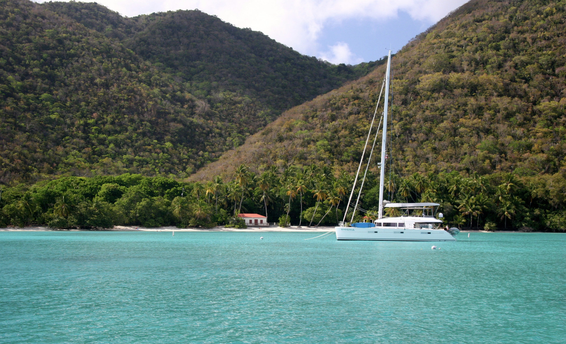
Located in the northeastern Caribbean, about 30 minutes by air east of Puerto Rico, The Virgin Islands are situated at the top of the curving archipelago that swings from Puerto Rico to Trinidad in the south. The US Virgin Islands are composed of 68 islands of which only three are populated. St. Thomas is the most developed and plays host to up to eight cruise ships a day. St. Croix, the largest of the three islands lies 40 miles to the southwest and St.John, the smallest of the three is largely comprised of national park.
With its close proximity to the British Virgin Islands (10 miles), small town charm, pristine beaches and numerous hiking trails, St. John has become a favorite of yachtsmen who enjoy the well-managed environment created by the National Park Service. Sail, swim, dive, explore, the U.S. Virgin Islands has something for everyone.
The Leeward Islands
The Leeward Islands of the Caribbean span some 200 miles and include ten main islands that embrace Anguilla to the north and west, then gently curving south to Dominica. The islands are rich in their respective history as well as diverse in their culture and languages. To visit them one ideally needs several months. Few of us are blessed with that opportunity, but even if one has to select, the variety offers the cruiser a myriad of choices. Anchorages in the Leewards can be near sophisticated, European-style cities, or off deserted white sand beaches with only the pelicans diving around your boat.
Sailing conditions throughout the Leewards vary somewhat. Up in the northeast from Anguilla to St. Martin and onto St. Barts, passages are short, making for easy, more leisurely cruising. These are the islands of stunning beaches, gentle, but scenic hills, sophisticated restaurants and duty-free shopping. Further south, the passages become longer, allowing for full exposure to the tradewinds and swells, making for exhilarating romps on the ocean.
Traveling south, the next island group includes Saba, Statia (St. Eustatius), St.Kitts (St. Christopher), Nevis, and Montserrat. These are the younger, more volcanic and steeply mountainous islands; they lie in a northwest to southeast orientation. Each has a distinctive culture and most have attractive historic towns. Montserrat has become famous for its still active volcano.
The final group of islands runs from Barbuda in the north to Dominica in the south. These include some of the most mountainous and dramatic islands, offering spectacular hiking, as well as some of the flattest, which offer the most beautiful beaches.
Download waypoints
The Windward Islands
From the French island of Martinique, the Windward Islands stretch southward nearly 200 miles to the island of Grenada and the last link before Trinidad and South America. The British referred to them as the Windwards, because to get there from many of their other possessions, you had to beat to windward.
They lie almost across the easterly trade winds, which makes for easy passages north or south and are just far enough apart to allow for some wild romps in the open ocean before tucking into the calm of the next lee shore.
The four main Windward Islands – Martinique, St. Lucia, St. Vincent and Grenada – are lush and richly tropical, with high mountains that trap the clouds and produce dense green vegetation. Here you can discover excellent examples of tropical rainforest, easily accessible to those willing to hike.
Between St. Vincent and Grenada lie the Grenadines – a host of smaller islands, some with hills reaching a thousand feet, other no more than a reef-enclosed sand cay sprouting a few palms. Drier than the large islands, they all have perfect white beaches, crystal clear waters and colorful reefs.
After the European colonists drove out the early Carib Indians, the islands saw many years of colonization and were fought over by the British and French. Plantation owners became rich from the production of sugar, and slaves were brought from Africa to work the fields. After slavery was abolished, many former slaves took to fishing and farming, rather than work the plantations for their former masters.
Today the intermingling of the races has produced an interesting blend of people who live in harmony together.
During its colonial past, Martinique, the northernmost Windward Island, was nearly always in French hands. Today it is still part of France and therefore a member of the European Community. The language and ambiance are distinctly French and while not essential, it certainly helps to speak a little of the language. St. Lucia, St. Vincent and Grenada are now all independent nations with their own laws and customs, albeit with a British tradition.
The Windwards are a joy for the sailor. Good trade winds ensure exhilarating passages and delightful anchorages abound. The weather is pleasant year round and the people are friendly.
Articles
The U.S. Virgin Islands install 200 Mooring Balls throughout territory that can be paid for on-line