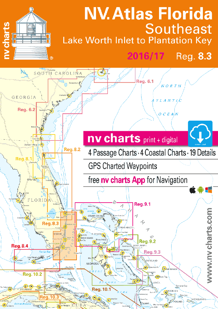
NV Atlas Florida 8.3: Southeast, Lake Worth Inlet to Plantation Key
$58.95
2016-2017 edition
NV Charts Reg. 8.3, Florida, Southeast, Lake Worth to Plantation Key
Format: Kombipack Papier / Digital download and App
- Digital charts download
- Coastal Charts
- Estuary Charts
- Details
- GPS Charted Waypoints & Approaches
Practical to use and accurate in the information and data published.
In stock
Description
2016-2017 edition
NV Charts Reg. 8.3, Florida, Southeast, Lake Worth to Plantation Key
Format: Kombipack Papier / Digital download and App
- Digital charts download
- Coastal Charts
- Estuary Charts
- Details
- GPS Charted Waypoints & Approaches
Practical to use and accurate in the information and data published.
- this Chart Kit is based on NOAA data with a new layout, clear cartography and international chart standards
- depths and heights are charted in feet
- north up chart orientation
- channel markers in red and green
- unique color differences, blue for the 6ft and 18ft depths, and green for exposed tidal areas
- contour lines for 12ft and 30ft depths
- underwater reefs are clearly marked with a light green color and the reef above water in darker green
- variable shoals marked in grey-blue
- lighthouses illustrate their light characteristics for better identification
- seaworthy chart layout – perfect chart flow from one chart to the next
- standardized chart scales – passage charts 1:340,000 – coastal charts 1:45,000 and detail charts 1:25,000 or less
- waypoints with latitudes and longitudes for GPS input
- recommended courses with distances
- arrow-symbols show buoyage direction
- tide information on each chart
Passage Charts
- C0 Caribbean Sea 1: 6,500,000
- C1 Florida 1: 1,300,000
- C2 Miami to Lake Worth Inlet & Bahama Banks 1: 340,000
- C3 Miami to Cape Sable 1: 340,000
- C4 Dry Tortugas to Big Pine Key 1: 340,000
Coastal Charts
- C5 Fort Lauderdale to Miami 1: 100,000
- C6 Miami to Key Largo 1: 100,000
- C7 Key Largo 1: 100,000
- C8 Key Largo to Long Key 1: 100,000
- C9 Long Key to Bahia Honda 1: 100,000
- C10 Florida Bay West 1: 100,000
- C11 Big Pine to Boca Chica Key 1: 100,000
- C12 Boca Chica to Marquesas Key 1: 100,000
- C13a Lake Worth Inlet to Delray Beach – North 1: 40,000
- C13b Lake Worth Inlet to Delray Beach – South 1: 40,000
- C14a Delray Beach to Port Everglades – North 1: 40,000
- C14b Delray Beach to Port Everglades – South 1: 40,000
- C15 Port Everglades to North Miami 1: 40,000
- C16 Miami North 1: 40,000
- C17 Miami South 1: 40,000
- C18 Biscayne Bay North 1: 40,000
- C19 Biscayne Bay West 1: 40,000
- C20 Boca Chita to Old Rhodes Key 1: 40,000
- C21 Old Rhodes Key to Carysfort Reef 1: 40,000
- C22 Key Largo East 1: 40,000
- C23 Card Sound & Barnes Sound 1: 40,000
- C24 Key Largo 1: 40,000
- C25 Key Largo to Plantation Key 1: 40,000
- C26 Plantation to Upper Matecumbe Key 1: 40,000
- C27 Upper Matecumbe to Long Key 1: 40,000
- C28 Long Key to Duck Key 1: 40,000
- C29 Duck Key to Fat Deer Key 1: 40,000
- C30 Fat Deer Key to Boot Key 1: 40,000
- C31 7 Miles Bridge 1: 40,000
- C32 Bahia Honda to Big Pine Key 1: 40,000
- C33 Big Pine to Sugarloaf Key 1: 40,000
- C34 Sugarloaf to Boca Chica Key 1: 40,000
- C35 Boca Chica Key to Key West 1: 40,000
- C36 Key West 1: 40,000
- C37 North of Sugarloaf Key 1: 40,000
- C38 Big Pine Key to Harbor Key Bank 1: 40,000
- C39 Dry Tortugas 1: 40,000
Details
- C40 Lake Worth Inlet 1: 20,000
- C41 Ft Lauderdale Approach 1: 15,000
- C42A South Fork New River 1: 15,000
- C42A Dania Cut-Off Canal 1: 15,000
- C42B Coconut Grove 1: 20,000
- C43 Bakers Haulover Inlet 1: 20,000
- C44 Miami Approach 1: 15,000
- C45A Boot Key Harbor 1: 20,000
- C45B Tortugas Harbor 1: 15,000
- C46 Key West 1: 20,000
Additional information
| Weight | 2 lbs |
|---|---|
| Dimensions | 17 × 12 × 0.2 in |